Return to Yosemite Valley to see the Falls
This past winter season left record breaking snowpacks in Yosemite National Park. In May the snowpack was 253% above normal in the Tuolumne River Basin and 231% above normal in the Merced River Basin. In July we decided to visit Yosemite hoping to see the falls in all their majesty.
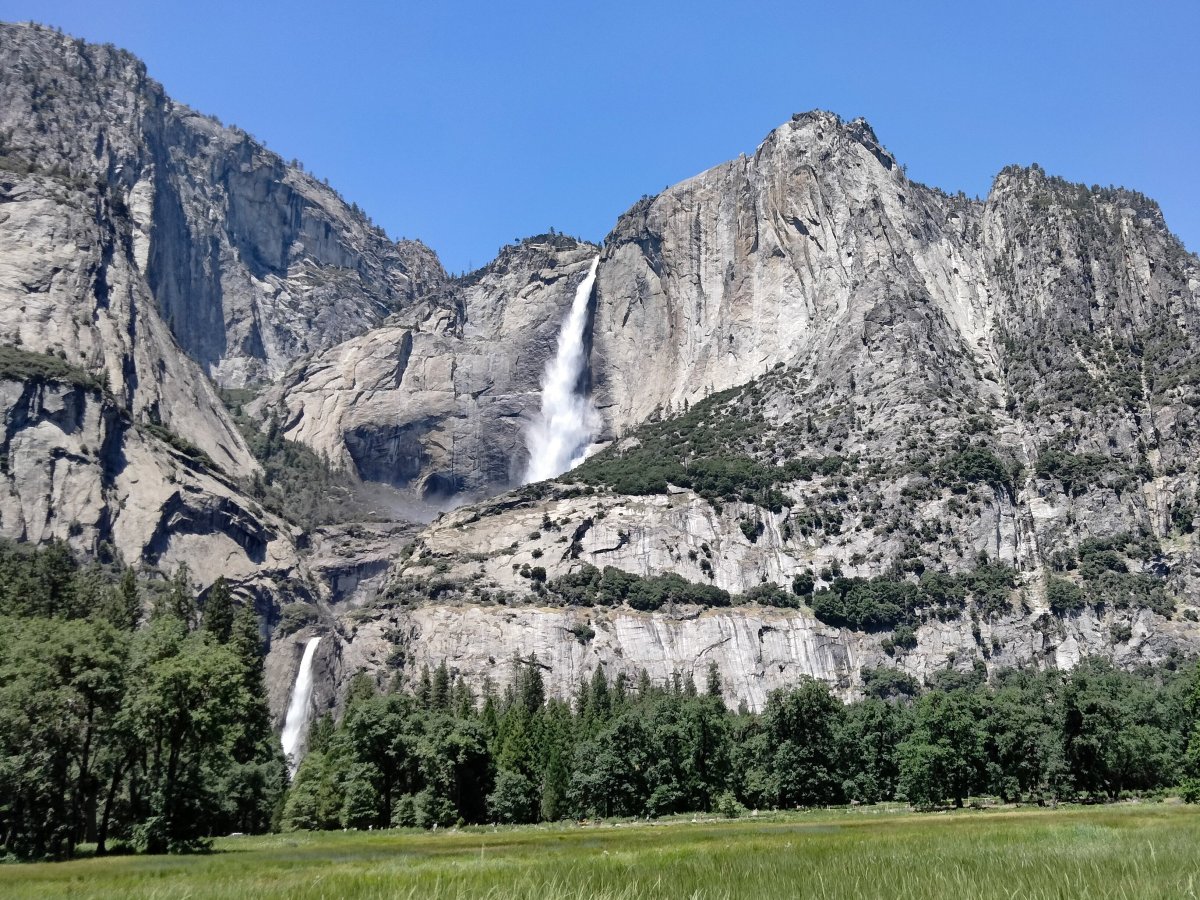
For this trip we rented a condo in the small community of Yosemite West. While it is still about a 30 minute drive to Yosemite Valley it is inside the Park so one avoids the Yosemite entrance lines. The first day we parked near Yosemite Valley Lodge and saw this view from the parking lot of the Upper Yosemite Fall with a little of the Middle Cascades.

We went the short distance to the base of the Lower Yosemite Fall. The wind blows the water coming down the falls making for a misty experience.

The water from the Yosemite Falls flows to join the Merced River.

Near the Lower Yosemite Fall was an area where people, mostly kids, were stacking rocks to make a rock cairn. While in some places these are used as trail markers in Yosemite they are not. Yosemite National Park follows the Leave No Trace ethics which has a goal to leave no signs of our impact on the land and respect creatures living in it so park rangers discourage making them.

We walked in Cook’s Meadow which is named for John J. Cook, who owned a hotel in Yosemite Valley from 1881-87 and grazed cattle in the meadow. In one direction is a view of Half Dome toward the center, with Royal Arches and North Dome on the left.

The meadow and mountains in the opposite direction.

And in between is a view with the Upper and Lower Yosemite Falls.

View from Swinging Bridge of the Merced River with North Dome and Half Dome in the background.

Near the bridge one can sit by the Merced River with the Upper Yosemite Fall in the background.

In afternoon when the sun starts to leave Yosemite Valley makes for a different mood of the Merced River with Sentinel Rock towering over it.

We stopped for a close view of Bridalveil Fall. When one of my cousins saw this picture she asked were is the water coming from as from this viewpoint there appears to be nothing behind it.

Driving on to the Tunnel View overlook shows just what is behind Bridalveil Fall which is in the center of the picture.

The next day we parked at Yosemite Village and took the bus to Happy Isles. Here is where the Merced River splits twice and forms two islands. This is a bridge to one of the islands.

A view from the bridge upstream of one split path.

Here is one of the splits in the foreground with the main river path in the distance.

This is a station used to track the water level of the Merced River. The station sends the information to a Geostationary Operational Environmental Satellite (GEOS) and the data ends up being stored in the USGS National Water Information System database which can be viewed by the public. North Dome is in the background.

A pretty flower not too far from the station.

Then we hiked to Vernal Fall and this is a bridge across the Merced River downstream from the fall.

From the bridge just a triangle of Vernal Fall is seen because trees have grown over the years to block the rest of the fall. We did not go farther and did not get a better view on this hike. The height of Vernal Fall is 317 feet.

View downstream from the bridge of the raging Merced River.

This is Illiloutte Fall with its cascade of water flowing from it. The height of this fall is 370 feet.

We hiked to Mirror Lake and while we did not see much of a reflection, at least we did see water as many years it is mostly meadow. The rocks behind are also interesting.

Yosemite West where we stayed provided good access to two viewpoints overlooking Yosemite Valley the first of which is Washburn Point. Half Dome is in the upper left. Following the ridge down toward the center of the picture is Grizzly Point. Behind it is Mt Broderick and behind this is Liberty Cap. To the right of Liberty Cap is Nevada Fall and down the the left is Vernal Fall.

A closer view of the falls showed us the full view of Vernal Fall. A half mile above is Nevada Fall which has a height of 594 feet.

The next viewpoint is Glacier Point with this view of the valley and the mountains beyond.

There was a fire started by lightening and due to its location was being allowed to burn out naturally. However it made some of the views a little smokey.

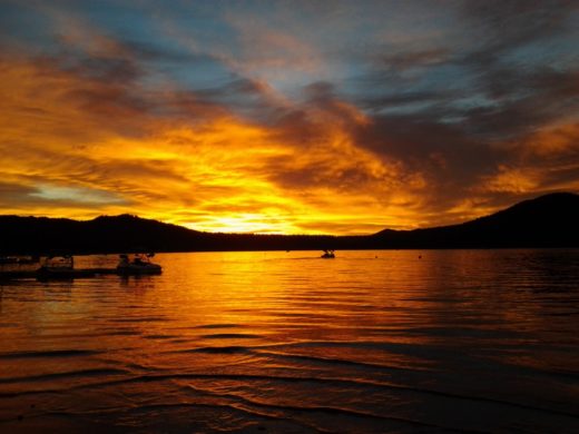
This post of our Yosemite visit ends with these two sunset views of Yosemite Valley.


We had a good trip and enjoyed the Yosemite scenery. We previously visited Yosemite in June 2019 which had a higher than normal precipitation that winter. Many of the pictures in this post are different so for more Yosemite beauty check out the Visit to Yosemite Valley to See the Falls post.
More Information:
National Park Service information
Wikipedia articles