Mississippi River in March
The water level of the Mississippi River always rises in the springtime due to melting snow in the North. However, the past two years the levels have become dangerously high. To prevent overflowing banks, flood gates of the Bonne Carre Spillway close to New Orleans are opened by the Army Corps of Engineers to divert some of the water to Lake Ponchatrain and prevent flooding both upriver and in New Orleans. When you cross the Mississippi River bridge to the small sleepy town of Port Allen, you have an entirely different perspective oo the high river. Here we walked along the levee at the Old Ferry Landing which is now a park. You can see how high the river is as you can barely see the roofs of the homes on the other side of the levee.

At our Lagniappe Dulcimer Festival, renown birder, Doug Pratt, led a birding walk through the town of Port Allen and up on the levee to listen to “bird songs” as a way to identify birds.

On the levee, I took photos of the Mississippi River in both directions showing the high water. In Baton Rouge, as of March 25, the river was three feet above flood stage at 38 feet.

Here is the river pointing south.

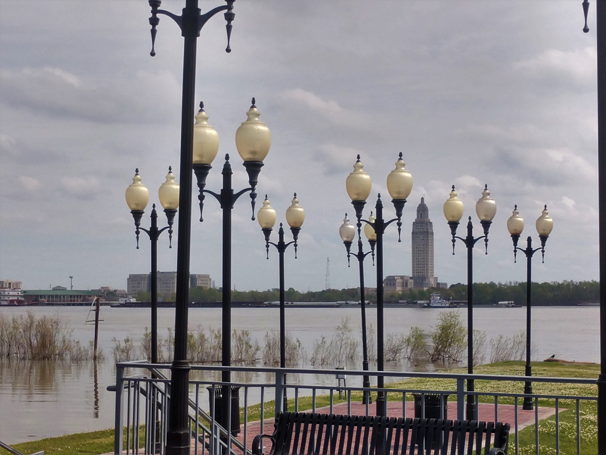
Across the river you can see the state capitol building. Clearly the largest building around.

Back at the park and ferry crossing, you can see the Mississippi River Bridge in the distance.

And barges are docked along the bank.

In the distance is another photo of the capital and downtown area of Baton Rouge.

The Mississippi River has flooded since Europeans settled along its banks. Levees have been built and failed. In the 1920’s levees were built and reinforced. However, the greatest flood recorded on the lower Mississippi River in 1917 showed that the levees failed again with loss of life and property. The subsequent 1928 Flood Control Act was passed with improvement in grades and models of the levees made by by the Army Corps of Engineers Several floodways to let water out in times of high river flow were built. These included the Morganza spillway (or West Achafalaya Floodway) and the Bonne Carre spillway. Levees fail by water seeping through the bottom of the levee as well as over the top. The C

The Mississippi River is the second longest river in North America, flowing 2,350 miles from its source at Lake Itasca through the center of the continental United States to the Gulf of Mexico.

Man has tried to harness the mighty flow of the Mississippi River with levees and spillways. Let’s hope they hold!