Pacific Crest Trail near Big Bear
This past summer we did a hike on the Pacific Crest Trail and saw beautiful flowers, nice scenery, and one ornery rattlesnake. The Pacific Crest Trail is a trail that goes from the Mexican border, passes through California, Oregon, and Washington going to the Canadian border. Our hike was a relatively short segment of the trail near Big Bear, California.
The starting point for our hike was East of Big Bear a little past the split where Route 18 goes toward Lucerne Valley and Balwin Lake Road continues around Balwin Lake. We parked in the turnout and went on the West side of the Route 18 highway where these signs mark the Pacific Crest Trail.

Shortly after starting our hike we came across this small budding cactus.

We saw lots of these plants, both the Spreading Phlox ground covering plants and the long stemmed plants.

A closer view of the Spreading Phlox.

And the long stemmed plants.

Joshua trees often grow in interesting ways as this one has.

Some upright growing Joshua Trees.

This is a view to the North of Lucerne Valley and the mountains beyond.

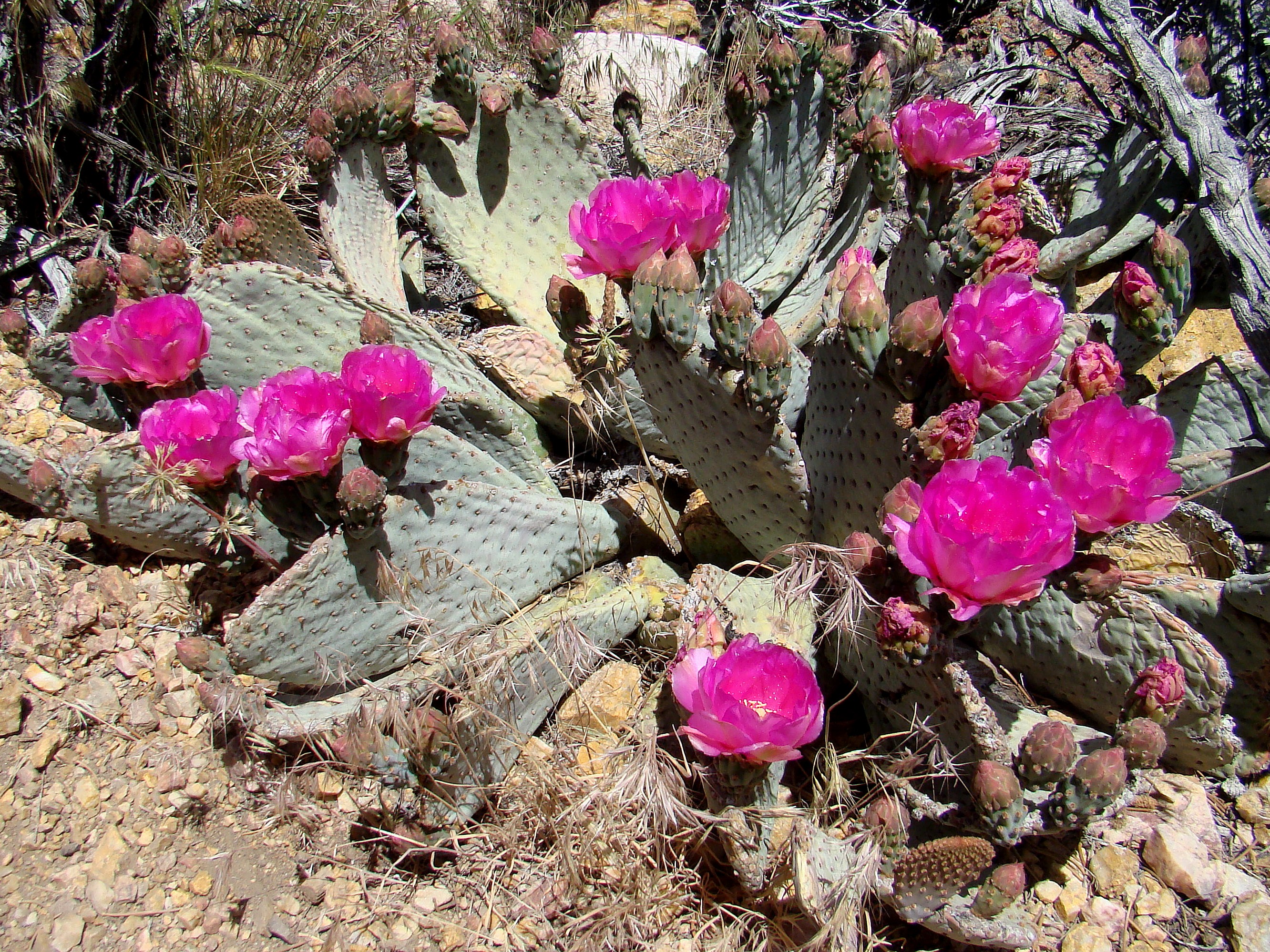
During the hike we came across many Beavertail Cactus in various stages of bloom.

A closer view of the buds and flower.

Some had many buds and flowers.

They really added color along the trail.

On the trail near one of the Beavertail Cactus was this rattlesnake. They normally do not strike unless one gets too close. This photo was taken with a telephoto lense and looks much closer than it was. After a little the rattlesnake went on its way in the opposite direction from us.

Indian Paintbrush with pretty red flower leaf bracts.

Another clump of Indian Paintbrush.

Another flowering plant.

This shrub had attractive yellow flowers.

Looking South toward the Baldwin Lake. This lake is only 25 feet at its deepest point and often will not have any visible water during dryer periods. As seen here it is essentially a large meadow teeming with wildlife.

Another view which shows more of the mountains near Baldwin Lake.

The trail crosses a road which goes to a landfill which served as our turnaround point and we returned to our starting point.

More Information:
Pacific Crest Trail Wikipedia article
Baldwin Lake (San Bernardino County, California) Wikipedia article
Halfmile’s PCT Maps has free maps covering the entire Pacific Crest Trail. Our hike was on California Section C page 7.